Your cart is currently empty!
Category: Uncategorized
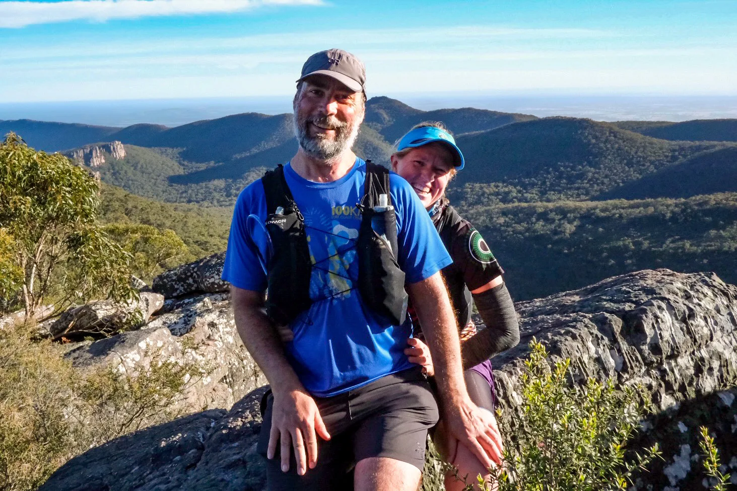
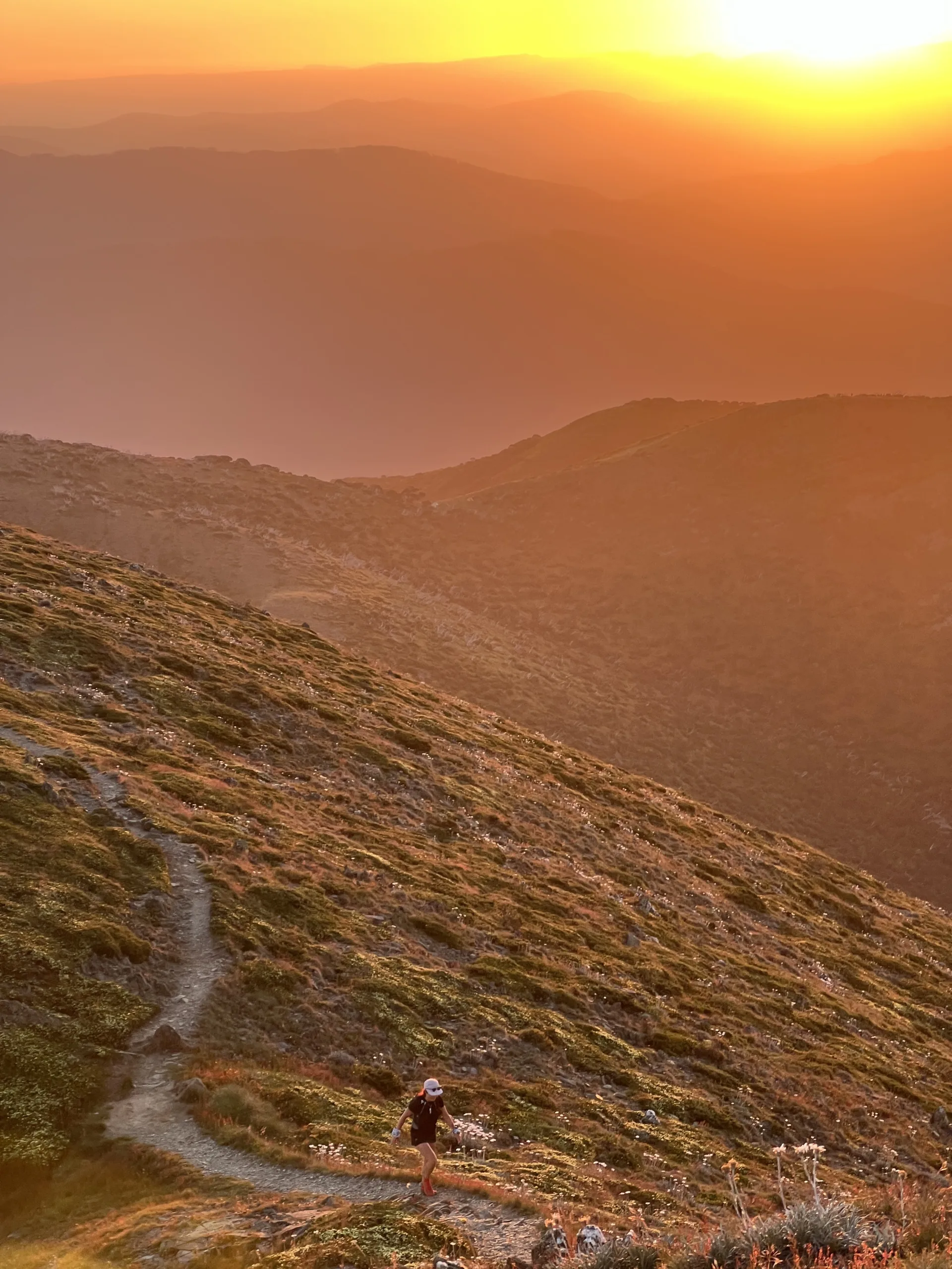
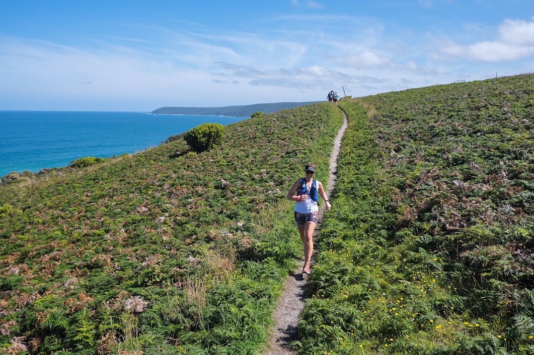
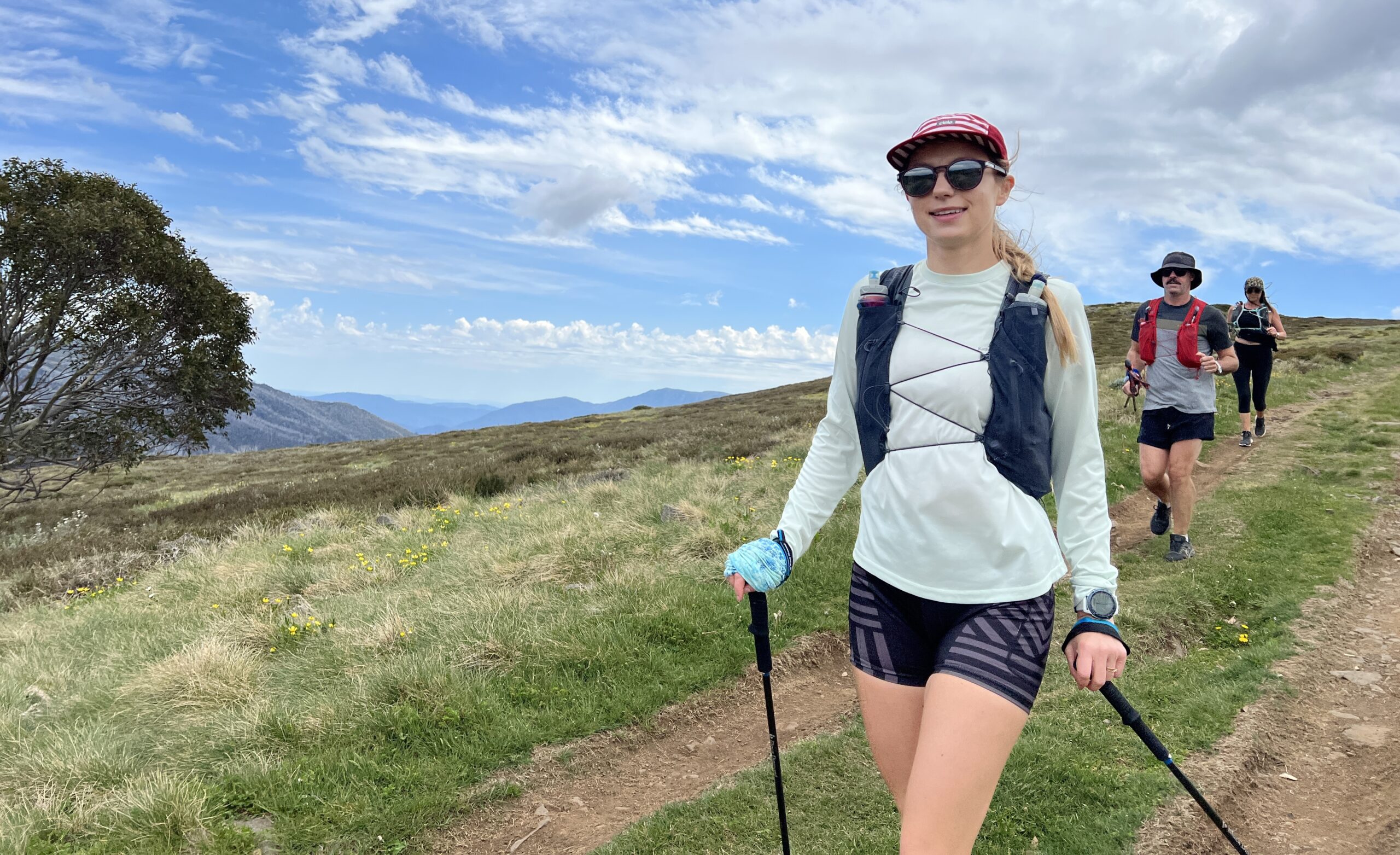
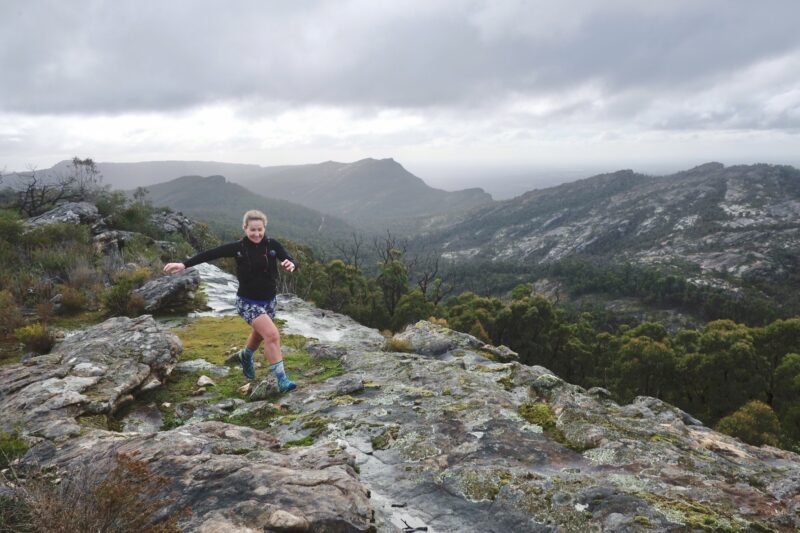
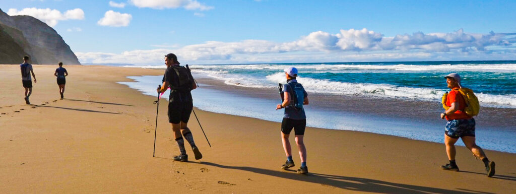
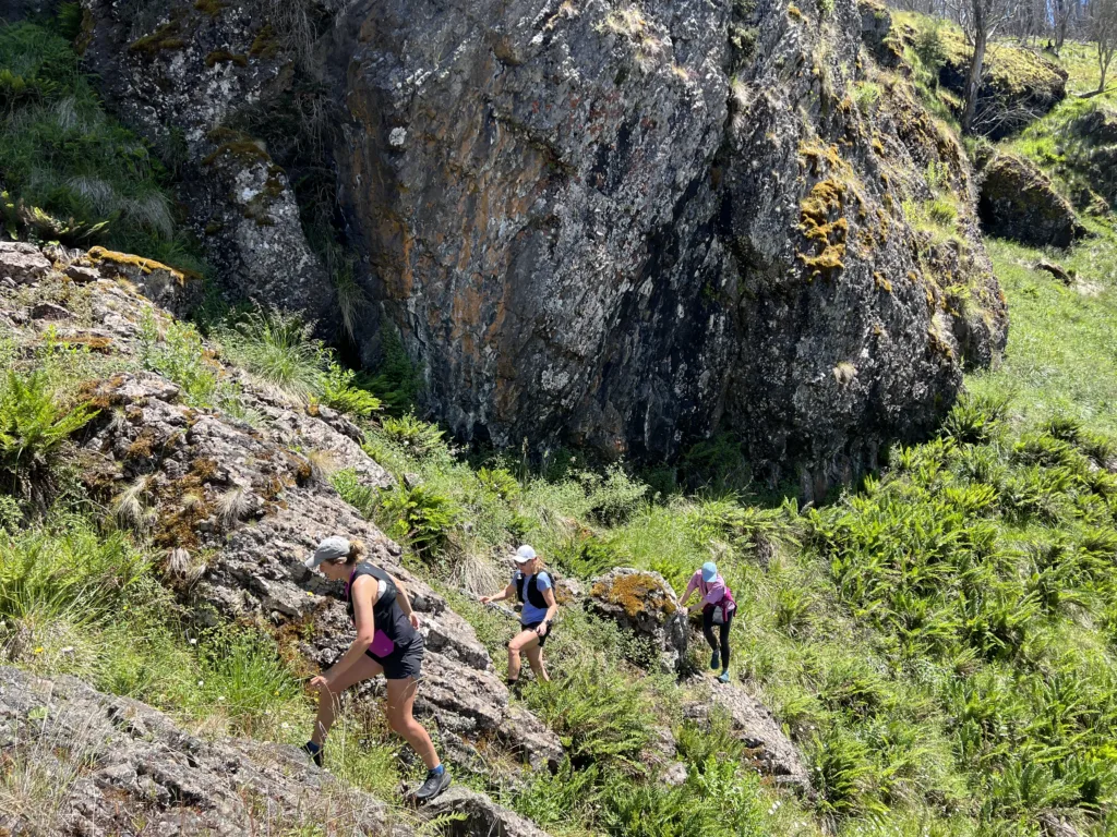
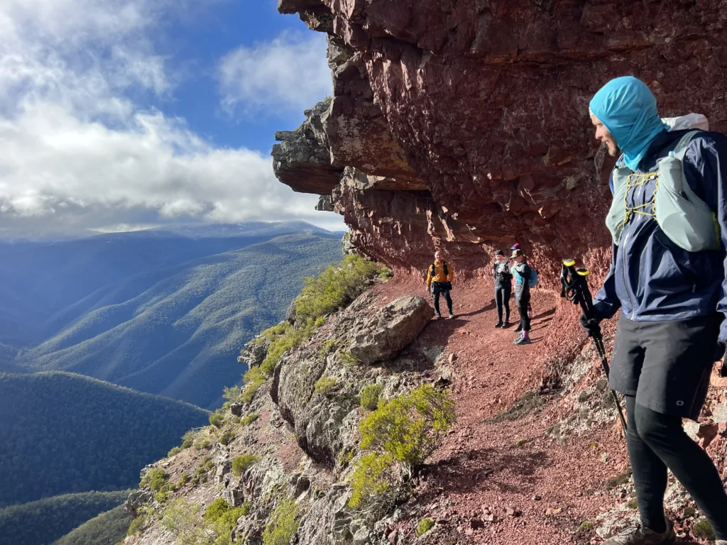
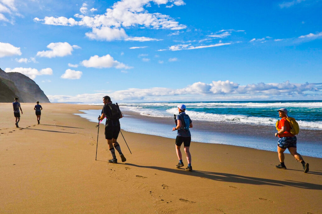
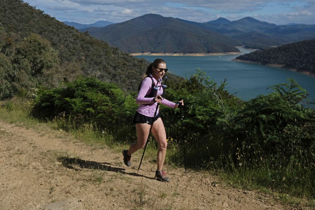
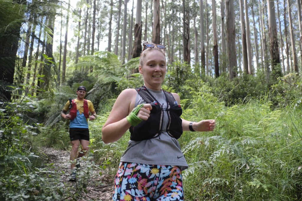
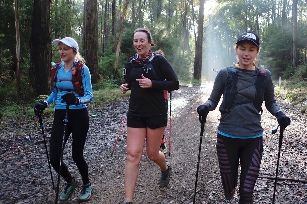
Will I hold anyone up on the tour? No, here’s why…
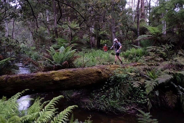
The most common concern we hear from those interested in joining us for a tour is that they may hold others up. We have spent a lot of time refining our group management processes to ensure every body goes their own pace. Our trail tours aim to be accessible and enjoyable for all. Here are some of the strategies we use to to cater to diverse participants in our tour groups:

- Adequate Guide Ratio: Ensuring personalised attention and safety, Trail Bus maintains a high guide-to-participant ratio. This allows the group to comfortably split into smaller units based on pace, experience, or preference.
- Short Course Options: Recognising that not all participants are up for long distances, Trail Bus offers shorter course options. This inclusivity allows people of all fitness levels to enjoy the experience without feeling pressured to keep up with more seasoned runners.
- UHF Radios: Essential for communication, especially in remote trail locations, UHF radios are used by guides for efficient and reliable contact, ensuring all group members are within reach and assistance is readily available if needed.
- Tour Route Marking: Trails are clearly marked to prevent anyone from getting lost, increasing confidence among runners, especially those new to trail running or unfamiliar with the area.
- Regroups: Regular regrouping points allow runners of different speeds to catch up, rest, and stay connected with the group, fostering a sense of community and ensuring the group moves together cohesively.
- Photo Opportunities: Recognising the scenic beauty of their routes, Trail Bus allocates time for photo opportunities, creating lasting memories and allowing for short breaks.
- Bus Aid Stations: Strategically placed aid stations provide hydration, nutrition, and first aid, offering a safety net for runners pushing their limits.
- Pre-Inspected Tour Routes: All routes are thoroughly pre-inspected for safety and suitability, taking into account terrain difficulty, weather conditions, and potential hazards.

These measures ensure that Trail Bus creates an inclusive and safe environment where the joy of trail running is accessible to people of all abilities, fostering a sense of community and shared adventure.
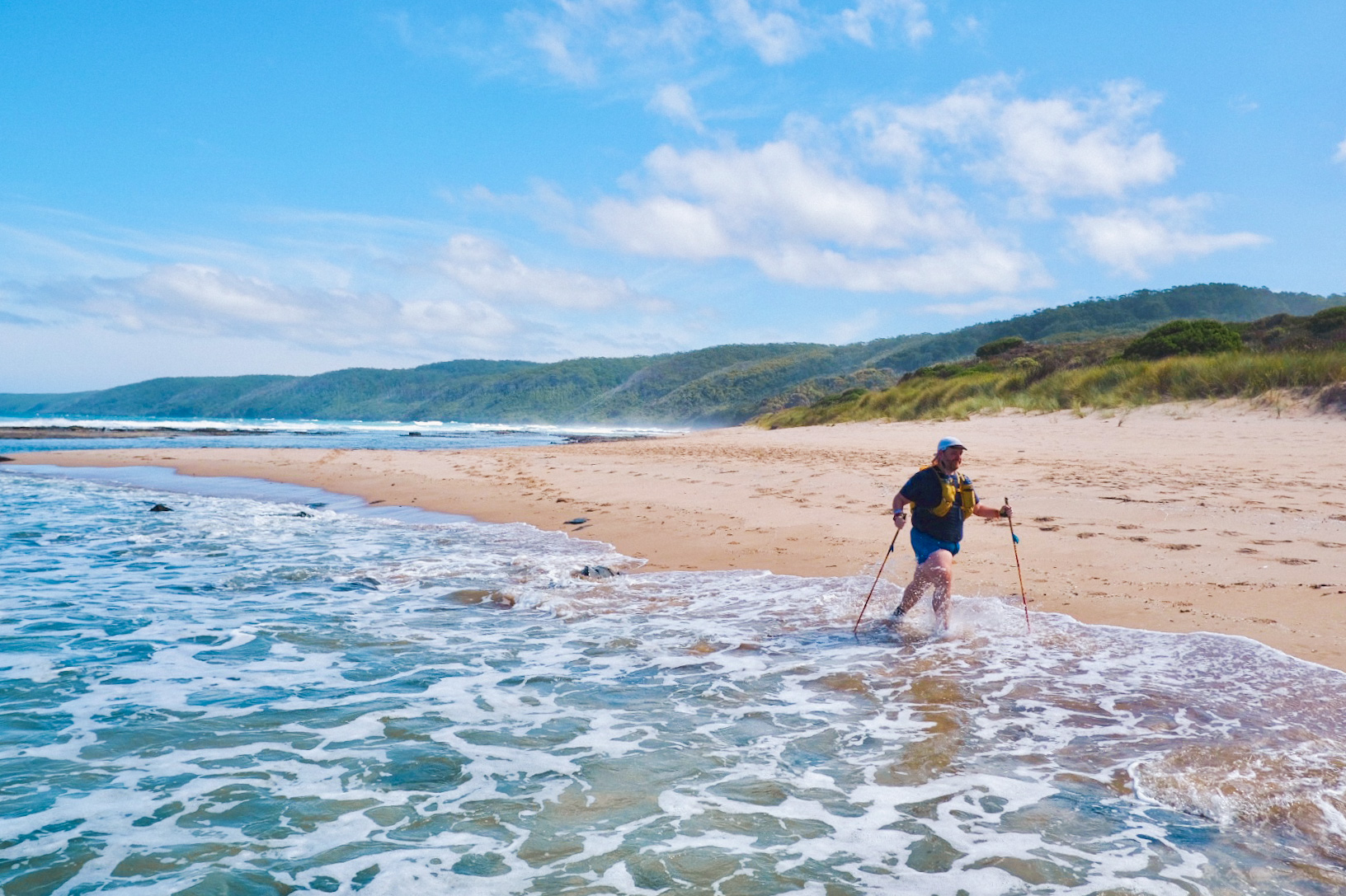
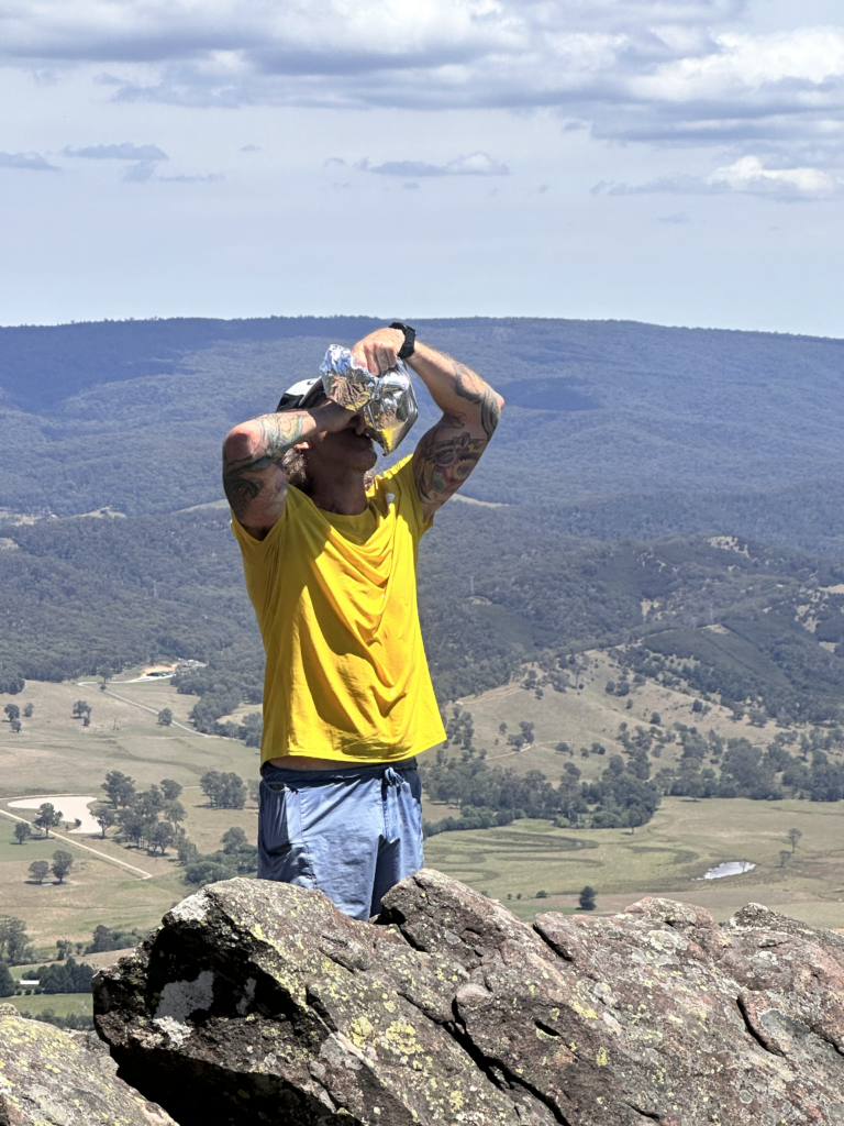
5 Victorian Trails Where Extra Water is a Must!
Embarking on a trail run is an exhilarating adventure, but safety should always be a top priority. Running out of water can pose significant risks during your trail escapades. Dehydration can compromise your performance and wellbeing. Stay ahead of the game by packing more water than you think you’ll need! 🚰 Here are key insights for five Victorian trails that demand extra hydration vigilance:

1️⃣ Mt Feathertop and Razorback: Brace yourself for a long and exposed journey as you tackle this trail. Cumulative hills, totalling around 800m elevation, and the relentless climb to Mt Feathertop make for a warm day of exposure. Water options are scarce, limited to an unreliable water tank at Federation Hut and a spring on Northwest Spur Track—both requiring treatment. There are no water sources along the Razorback until you reach Mt Hotham Resort.
2️⃣ Cathedral Range: Once you ascend from Little River in the Valley, anticipate no water sources until your return. The ridge line, marked by technical terrain and limited shade, can be exhausting. The 12km North and 10km South circuits are split for a reason—prepare for a challenging, water-scarce adventure.
3️⃣ 8-Mile Spur track. 8 mile camp site, Howqua River to The Bluff (10km one way): Expect a steep, overgrown, and slow-going trail with limited water sources. Once you leave Howqua River, there’s no water available for the remainder of the day. The challenging descent from the top can be just as demanding. Extend your day by heading 4.5km along the Bluff to Bluff Hut, which has an unreliable tank as the only water option.
4️⃣ **Wilson’s Promontory North Circuit:** This coastal and remote trail lacks vehicle access and reliable water sources. Navigating and scrambling through the elements can extend your exposure, emphasizing the crucial need for ample water.
5️⃣ The Crinoline Circuit: At the base of the circuit, there’s ample water from The Wellington River. However, brace yourself for a water-scarce trail beyond. Your only water options include an unreliable creek at Long Hill and old water storage drums that may be stagnant. Navigating the route, with limited cover, coupled with arduous climbing and scrambling, can lead to many exhausting and exposed hours on the trail. Ensure you carry sufficient hydration for the entire run, stay safe, and follow us for more expert tips on making the most of your trail running adventures! 🏃♀️🏞️ #trailrunning #safetyfirst #trailbustours
If you would like to tour any of these locations or more just get in touch here: Contact Us
How did the Grampians rock formations occur?
The geological sandstone rock formations at the Grampians in Victoria, Australia, were shaped through a series of intricate processes that occurred over millions of years. Here’s an overview of how these formations came to be:
- Deposition of Sediments: The formation of sandstone begins with the deposition of sediment, often sand-sized particles, in a particular environment. In the case of the Grampians, these sediments were likely deposited in ancient riverbeds or coastal areas.
- Compaction and Cementation: Over time, the accumulated sediments become compacted under the weight of new deposits above them. As this compaction occurs, minerals dissolved in groundwater seep into the spaces between the sediment particles, binding them together. This process is known as cementation.
- Formation of Sandstone Layers: As the sediment becomes compacted and cemented, it forms distinct layers of sandstone. Each layer represents a period of sediment deposition followed by compaction and cementation.
- Uplift and Erosion: Geological forces, such as tectonic activity and uplift, can push the sandstone layers upward. Once the sandstone is exposed at the Earth’s surface, weathering and erosion processes begin to shape the rock. Wind, water, and temperature changes break down the rock’s surface.
- Formation of Features: Erosion carves out various features in the sandstone, such as valleys, cliffs, and rock formations. Over time, the rock becomes more susceptible to weathering due to its exposure at the surface.
- Differential Erosion: Different layers of sandstone have varying resistance to erosion based on their composition and compactness. Softer layers erode more quickly, creating distinctive patterns and shapes in the rock formations. This is why you often see intricate patterns and overhangs in sandstone landscapes.
- Creation of Unique Landmarks: The combination of differential erosion, weathering, and the resistant nature of sandstone leads to the creation of iconic landmarks like rock arches, towering cliffs, and other distinctive formations found in the Grampians.
Throughout this process, the geological history of the region unfolds, revealing layers of sedimentary rock that hold clues to past environments and geological events. The Grampians’ sandstone formations provide a remarkable glimpse into the Earth’s ancient past and the ongoing forces that shape our planet’s landscape.
Come check out the stunning geology of Gariwerd on a Grampians Peaks trail tour with us
https://trailbus.com.au/product-tag/peaks-trail/
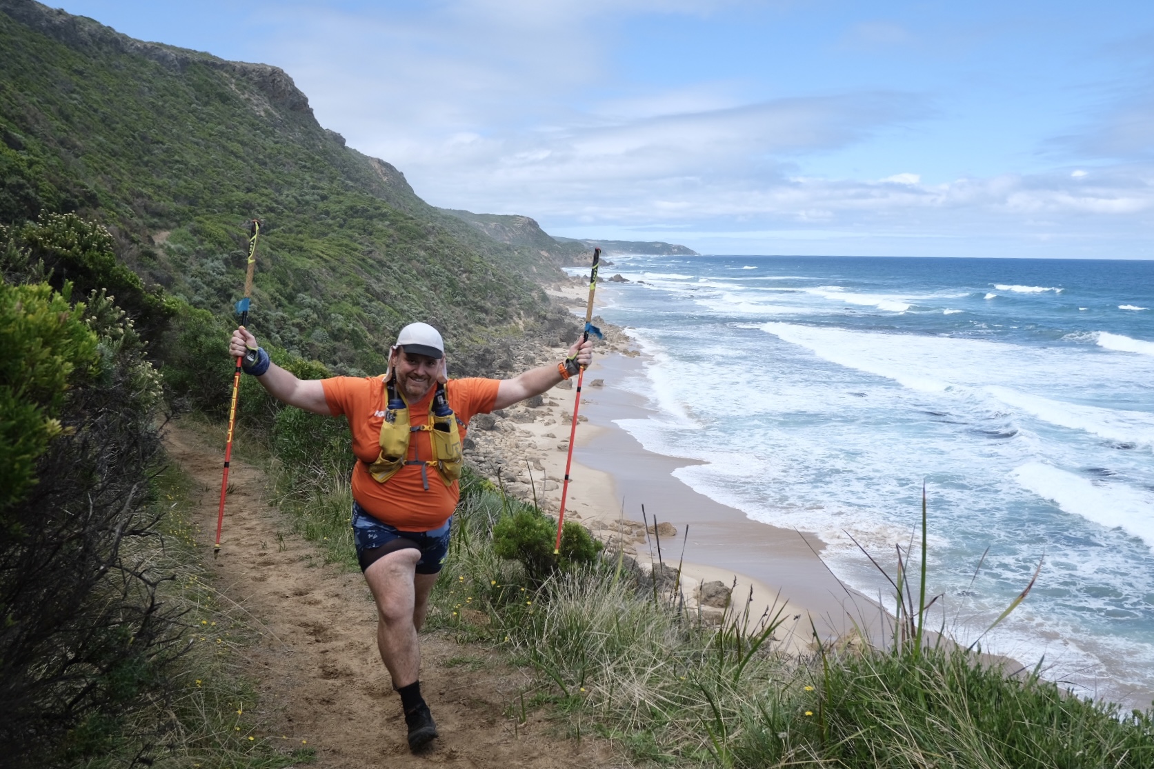
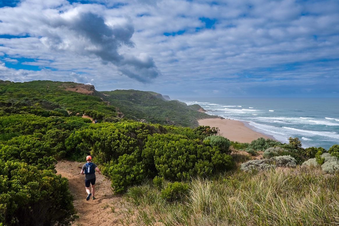
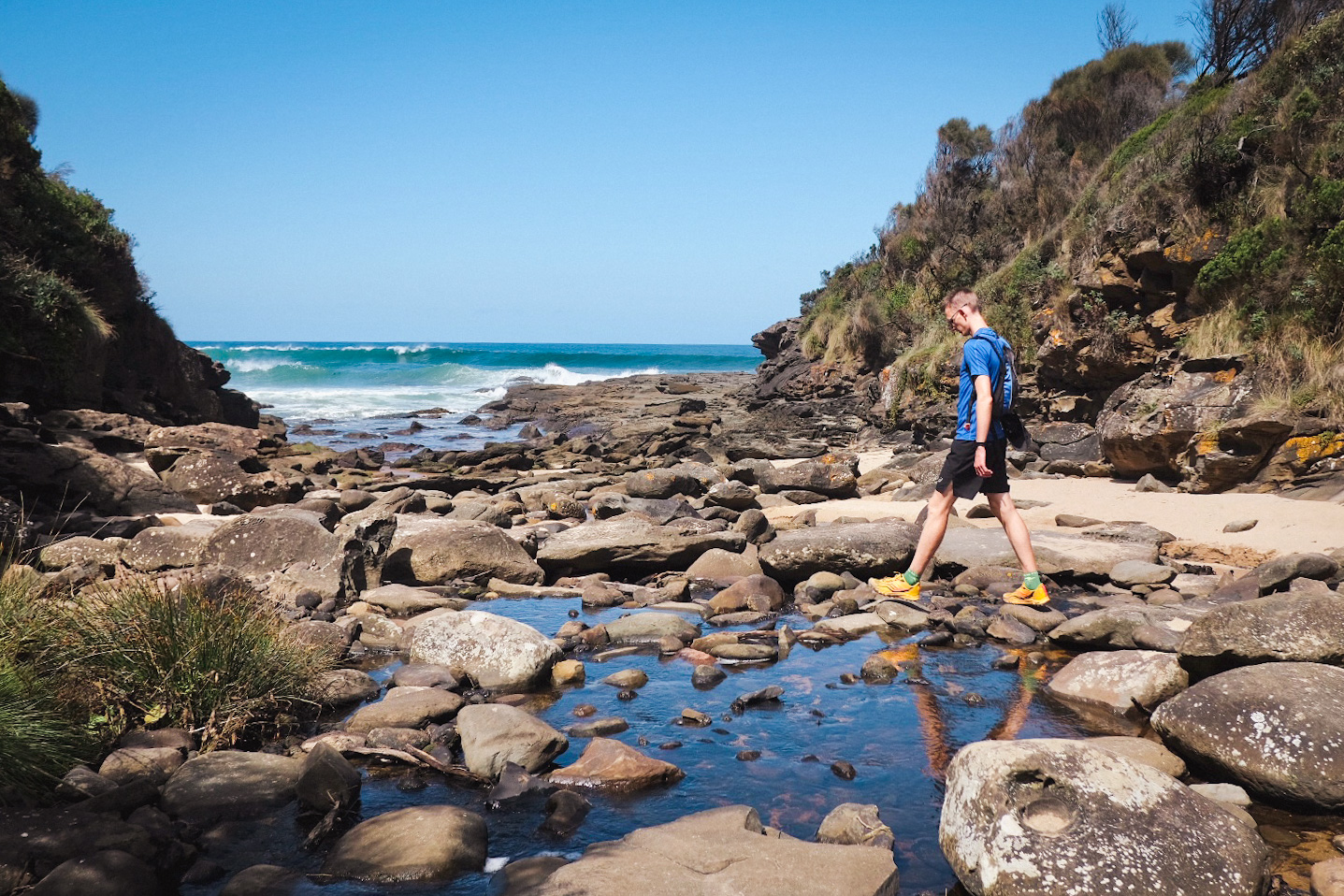
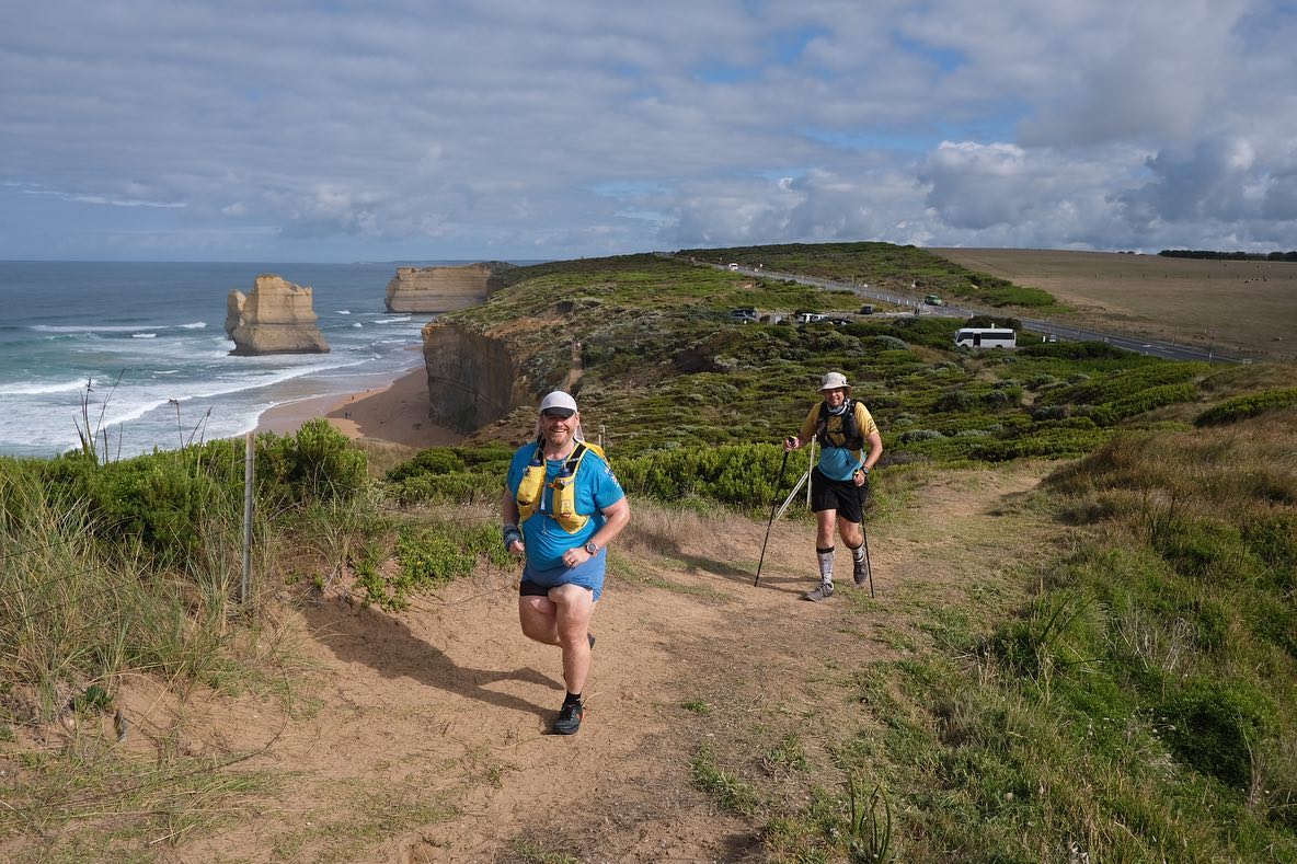
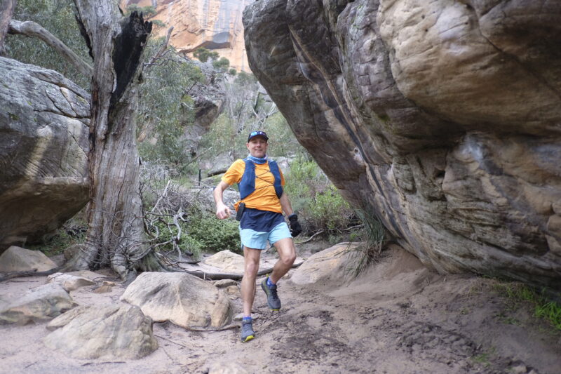
10 Reasons why every trail runner needs to run the 100km Great ocean Walk
10 reasons why trail runners should experience the 100km Great Ocean Walk trail from Apollo Bay to Port Campbell National Park and witness the stunning 12 Apostles along the way in Victoria, Australia:
(1) Spectacular Coastal Scenery: The Great Ocean Walk offers breathtaking views of the rugged coastline, pristine beaches, towering cliffs, and the iconic 12 Apostles. Running along this trail allows you to immerse yourself in the beauty of the natural landscape.

(2) Challenging Terrain: The trail provides a mix of challenging terrains, including undulating paths, sandy beaches, forested sections, and rocky cliffs. It offers an exhilarating and diverse running experience, keeping you engaged throughout the journey.

(3) Wildlife Encounters: As you traverse the Great Ocean Walk, you have the chance to spot various native Australian wildlife, such as kangaroos, wallabies, koalas, echidnas, and a variety of bird species. It adds an element of excitement and wonder to your trail running adventure.

(4) Tranquil Environment: The Great Ocean Walk is known for its peaceful and serene atmosphere. Away from the hustle and bustle of city life, you can find solitude and tranquility, providing a perfect escape for runners seeking a mindful and meditative experience.
(5) Fresh Ocean Breezes: The trail follows the coastline, allowing you to enjoy the refreshing ocean breeze as you run. The clean, salty air invigorates your senses and enhances the overall experience of being out in nature.
(6) Trail Infrastructure: The Great Ocean Walk offers well-maintained trails and amenities, including campsites, picnic areas, and lookout points. These facilities ensure a comfortable and convenient journey, with opportunities to rest, refuel, and appreciate the surroundings.

(7) Cultural Heritage: Along the trail, you can explore the rich Aboriginal and European cultural heritage of the region. From ancient Indigenous sites to shipwreck relics, there are historical landmarks that add depth and significance to your trail running adventure.

(8) Sense of Achievement: Completing the 100km Great Ocean Walk is a remarkable accomplishment for any trail runner. The sense of achievement and satisfaction you’ll experience as you cross the finish line at the Port Campbell National Park will be unforgettable and highly rewarding.
(9) Community and Camaraderie: The Great Ocean Walk attracts a community of like-minded trail runners and outdoor enthusiasts. Participating in this trail allows you to connect with fellow runners, share experiences, and form lasting friendships with individuals who share your passion for adventure.

(10) Unforgettable Views of the 12 Apostles: Perhaps the most iconic attraction along the Great Ocean Walk is the majestic 12 Apostles. These towering limestone stacks rising from the Southern Ocean provide a truly awe-inspiring sight. As a trail runner, you’ll have the opportunity to witness these natural wonders up close and create memories that will last a lifetime.
Embark on this 100km trail running adventure along the Great Ocean Walk, and you’ll be rewarded with unforgettable experiences, stunning scenery, and a profound connection with nature. Our guides and bus will be right there supporting your every step. Our bus shuttles you to and from our optional accomodation daily and we include city transfers. We always have pre run access to the bakery and post run access to the supermarket and Apollo Bay’s cafes and restaurants. All you have to do is grab your running and chill out gear and meet the bus in the city. If you have any questions drop us a message on 0458 641 415 or any of our socials.
Chris Wright – Trail Bus Tour Operator
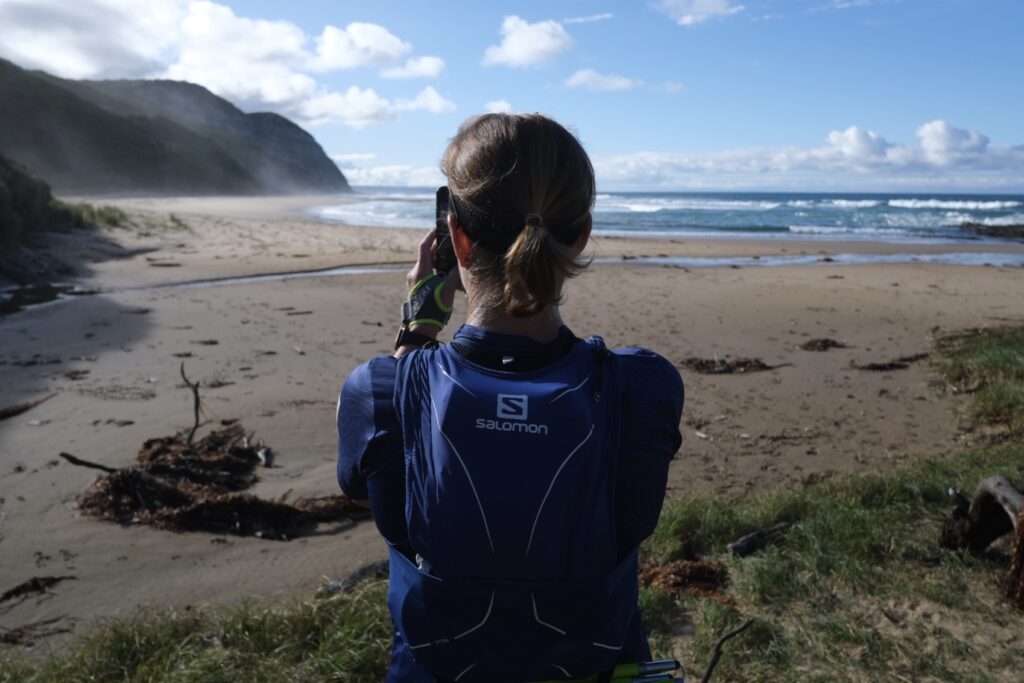
How to navigate routes outside of phone reception

Here we give you a simple breakdown of how to follow routes and tracks from your tech devices. This will help you get around the trails and keep safe when planning on hitting new locations.
We run through the basic navigational tech tools watches and smart phones. For all nav tech devices we advise reading their manuals and spend some time testing them before heading remote.
It’s tech, even the best quality gear fails occasionally. Our tours guides use a 3 tier offline navigation system in anticipation for when a tech mapping device wigs out.
- GPX watch routes. How to add GPX routes to your Garmin GPS watch, How to download and follow routes on a Coros watch, How to use maps and routes with a Suunto watch
- Phone apps – Maps.me, AVENZA maps, GAIA maps
- GPS Garmin Rino units

What are the things that offline map tech can do
- Show you a planned route to follow
- Show you which turns to take
- Help you plan for change and discover alternative route options
What offline maps can’t do
- Tell you how long the trail will take for you
- Give you up to date trail conditions (closed or impassable). Things change and so do trails. Just because it’s on a map doesn’t mean its passable or a trail even still exists.
- Tell you what warnings are active on those trails (park closures, park activities, burning, shooting, baiting, flooded, fire season warnings)
- Tell you if the trail is technical or not
- Tell you the last time someone used that trail
- Tell you what other trail users are out there or how they use it
When in doubt turn back. You know what you’ve seen and doing this keeps you on your planned route. Changing route plans without letting others know will effect the safety of anyone that comes looking for you.
Different tech is better at different things. Watches are best for on the move navigation. The bigger screens and intuitive nature of mobile phones come in handy when looking at alternative routes, reviewing turns or reassessing when you are off course.
Watches
Pros – Easy to see with regular convenient peeks at your watch, sometimes routes may glitch, long battery life and battery saving options, added safety and navigation features, water resistant.
Cons– Small screens can make it difficult to see what is around you, can lack base map detail (especially when zoomed out), takes a while to get used to all the functions, finding a satellite signal can take a bit of time, difficult to get a bearing at trail intersections once you have stopped (run back down the trail you came from, turn around and return, as you return look at your watch to find your directional bearing)
Phone Apps
Pros – Larger screens, more intuitive, easier to see what’s around you and change routes
Cons – May not be weather proof, battery drain whilst navigating or when using apps, your more likely to drop and damage phones then watches
3 days in Murrindindi
3 days in Murrindindi
We recently had an enquiry asking where to visit in the Murrindindi area across 3 days. We absolutely love the Dindi trails. There is so much bang for your buck and it’s all so different and close to each other. It was a challenge to shortlist it down to only 3 days. Below is the list we put together. Please share with us your favourite spots and get out there and see the Dindi magic for yourselves. We had to give an honourable mention to Cathedral Range State Park which is currently closed.
lake Eildon
- Drive to Foggs Lookout https://goo.gl/maps/kf4WX8xLietkdjrY7 and Eildon Spillway Lookout https://goo.gl/maps/8iZedLFwyd1reLzs9
- and a 10km hike https://www.victoriashighcountry.com.au/listing/blowhard-spur-circuit-devils-river/ starting and finishing at intersection of Keg Spur track and Fraser park rd https://goo.gl/maps/hgJnDmw8JhFe16pX8
- Take water and go early to beat the heat. First aid kit, snake bandage.
Food and drink
- Grant St Grocer https://goo.gl/maps/x5mrS7axxoqBTUqMA
- Alexandra Hotel https://goo.gl/maps/NFrxMMJxdp3ge2vq7
Lake Mountain and Marysville
- Lake Mountain hiking loop 4.5km approx 1 hour https://www.victoriashighcountry.com.au/listing/lake-mountain-summit-walk-marysville/ starting and finishing at Lake Mountain Alpine Resort https://goo.gl/maps/oWu1vEK5CSk6E1vS7.
- Marysville Stevenson falls out and back 10km https://www.strava.com/routes/3042410114532669688 Make sure you got to the bottom and top of the falls.
- Starting and finishing at Gallipoli Park Toilets https://goo.gl/maps/9ekFpQHw1Zwu4qdn9
- Easy short walk options drive to Steavenson falls carpark https://goo.gl/maps/Tq89VrhANfYHzBYP8 and to Keppell lookout https://goo.gl/maps/TUXxQcTnYEVfPViY8
Food and drink
- The Duck Inn https://goo.gl/maps/7rGPGUjcYXvPpNcCA
- Marysville Bakery https://goo.gl/maps/dWcKY1p7kt7yd3KZA
Murrindindi, Toolangi and Healesville
- Murrindindi reserve https://goo.gl/maps/Z6GH2hWC25jEJvjg9. Toilets and picnic tables.
- Wilhelmina falls 4.5km hike https://www.strava.com/routes/3042412624744801254
- Murrindindi cascades short walk https://goo.gl/maps/xmxf1nwLjHdqxY39A Short walk down track across the road opposite the picnic area. Toilets and picnic tables.
- Drive the Black Spur https://highcountryonline.com.au/black-spur-drive-victoria/
- Toolangi boardwalk and myrtle gully loop https://www.visitvictoria.com/regions/high-country/see-and-do/outdoor-and-adventure/walking-and-hiking/myrtle-gully-circuit. Toilets and picnic table.
- Short option walk the boardwalk https://www.visitvictoria.com/regions/high-country/see-and-do/outdoor-and-adventure/walking-and-hiking/wirrawilla-rainforest-walkw
Food and drink
- Healesville Herd Bar https://goo.gl/maps/qQMaZB4ersQZfX896
- Monroe’s Burgers https://goo.gl/maps/YVwmxyCNEvRqib947
- Matilda Bay Brewery https://goo.gl/maps/ceM75WDEj7nwMsSS6
- Four Pillars Gin Distillery https://goo.gl/maps/wb48ZZkD4tYRfGMa6
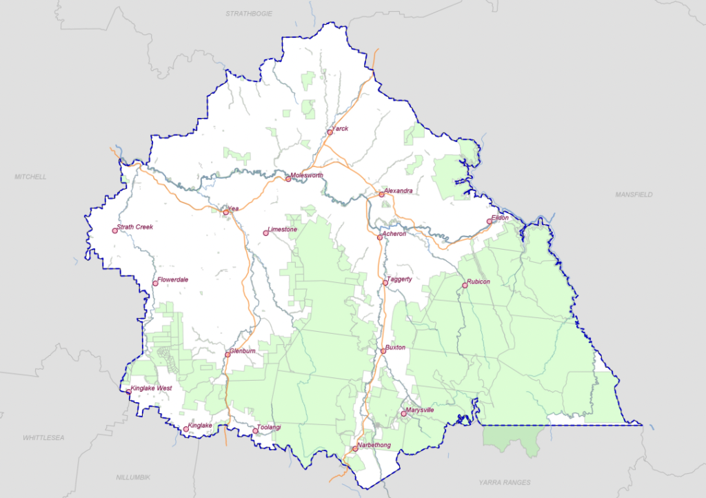
How to find allocated logging AREAs in Victoria
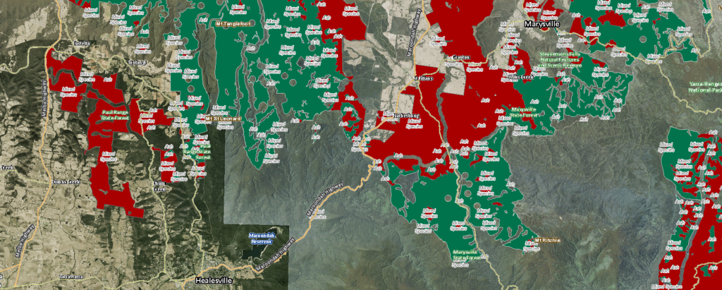
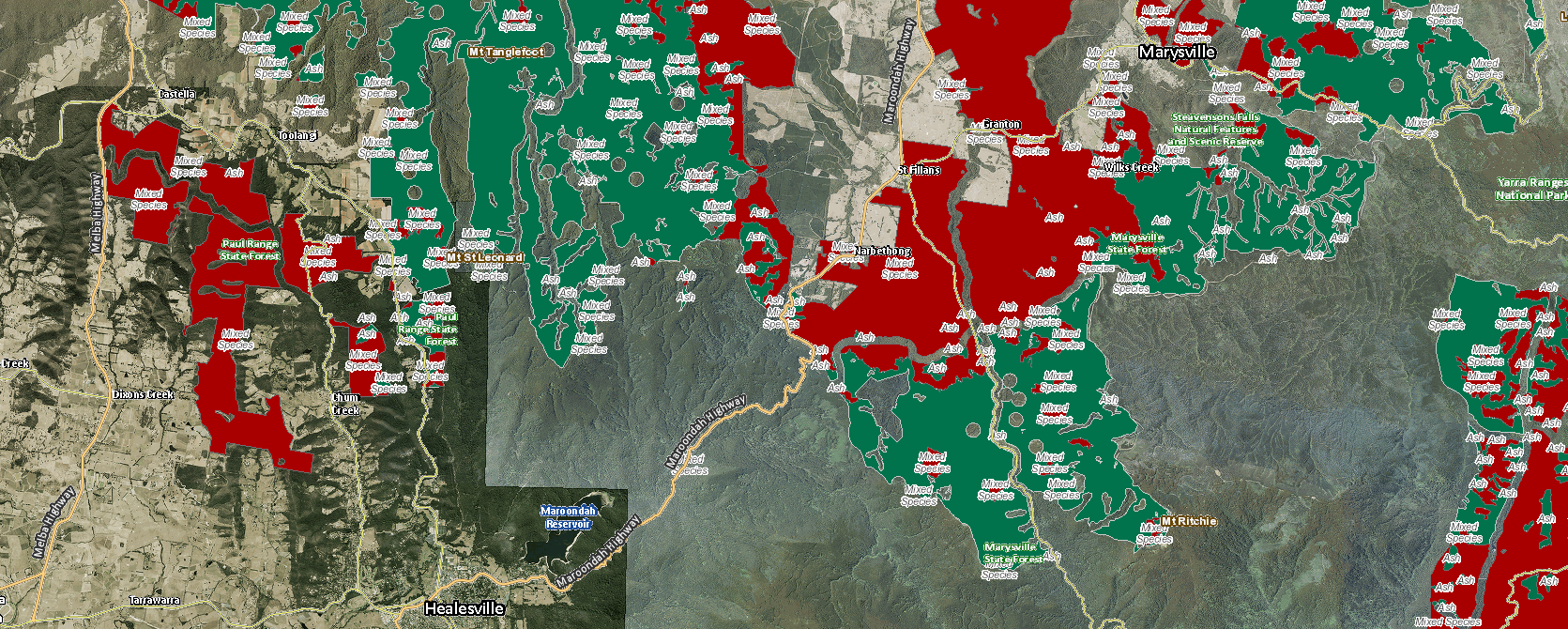
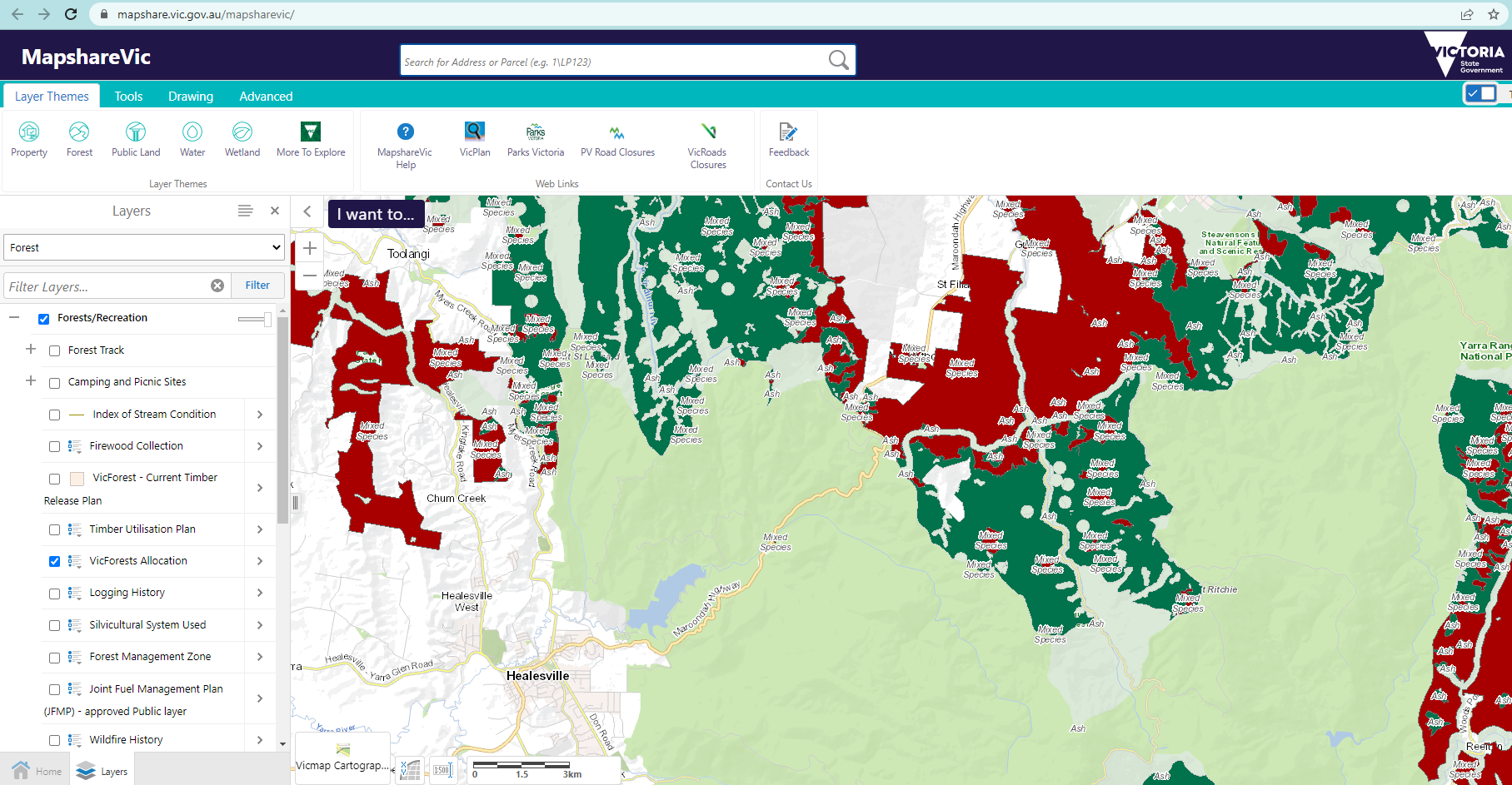
A snapshot of the VicForest logging allocations in the Murrindindi and Yarra Ranges area (red for Mountain Ash trees, green for Mixed tree species). The large clear forested area mainly comprises of the Yarra Ranges National Park. We trail run these natural, beautiful and wild Victorian places and we want all others to have similar positive opportunities and experiences. The quality of our customers tour experience is influenced by the ecological condition of the forests. Native logging is one of the many environmental impacts happening in our Victorian natural places right now. It impacts the quality, condition and amount of habitat our native plants and animals have.
Whilst logging is analysed for its sustainability, logging native forests will always impact on the ecosystem’s biodiversity, ecology, the native animals and plants that live there. We see these impacts first hand and we look forward to a future where we transition to a state that is free from native logging. We want our forests to continue to grow and provide homes to all our beautifully diverse native species.
Our first step towards understanding the impacts was GETTING OUT THERE and trail running. Trail running in Victorian State Forests gives you some of the most quiet and naturally immersive trail running experiences. In these forests you can connect with nature and the logging operations (past and present) in that area. Keep in mind always put your personal safety first and follow the logging operations signage and access requirements. If there is an unsafe act or condition to public as a result of the operations contact the land manager or DELWP (the responsible Government Department).
Give yourself a reason to seek more information on logging and learn about why it exists and the impacts it has. Economy, industries, communities, families and individuals rely on logging. There are social and community effects that come with logging reform and changes. Knowing this can help people understand others emotional connections, perceptions and reasoning, to help work through joint strategies that are mutually beneficial and develop practical solutions.
You can learn about the existing processes used by VicForest “a state owned business managing the harvest, sale and regrowing of sustainable timber from Victorian State forests on behalf of the Victorian government.” https://www.vicforests.com.au/operations/harvesting-process1
When I found out about the areas and amount of land allocated to Vicforests, firstly I was surprised that I could access that information. I only stumbled onto to the feature when doing some of our desktop tour planning on the Victorian Government database https://mapshare.vic.gov.au/mapsharevic/. Secondly I was blown away by the shear amount and the locations which had been logged and were planned to be with the Vicforest land allocations.
Here I will show you how you can check out VicForest allocations on a computer (it’s a bit more fiddly on a mobile phone but drop a comment if you would like to know)

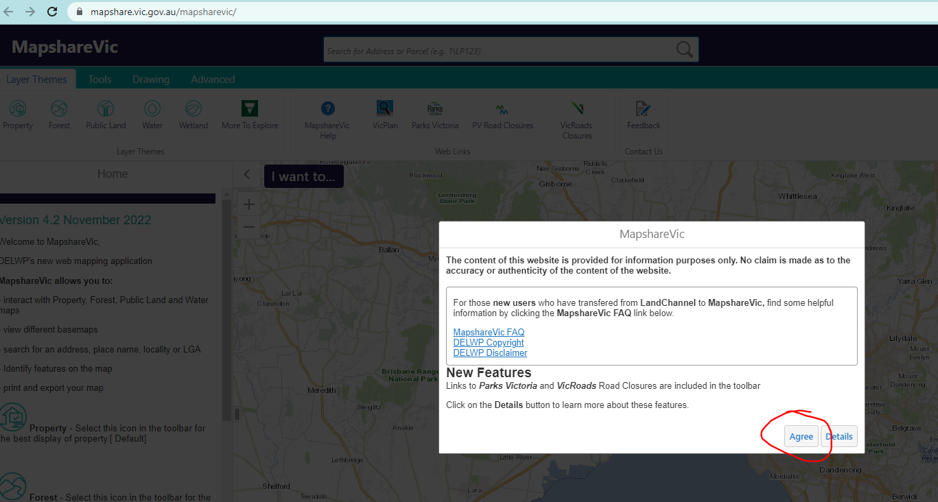
1. Open up the Victorian Government database website https://mapshare.vic.gov.au/mapsharevic/, and hit agree. 
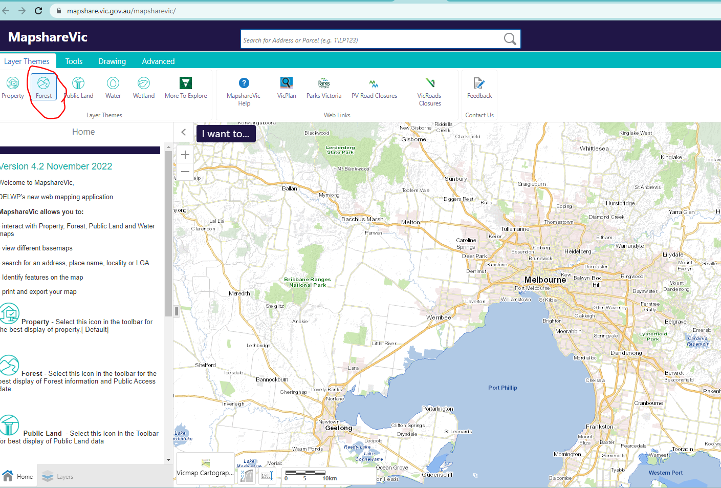
2. Hit the Forest filter in the top left of the toolbar 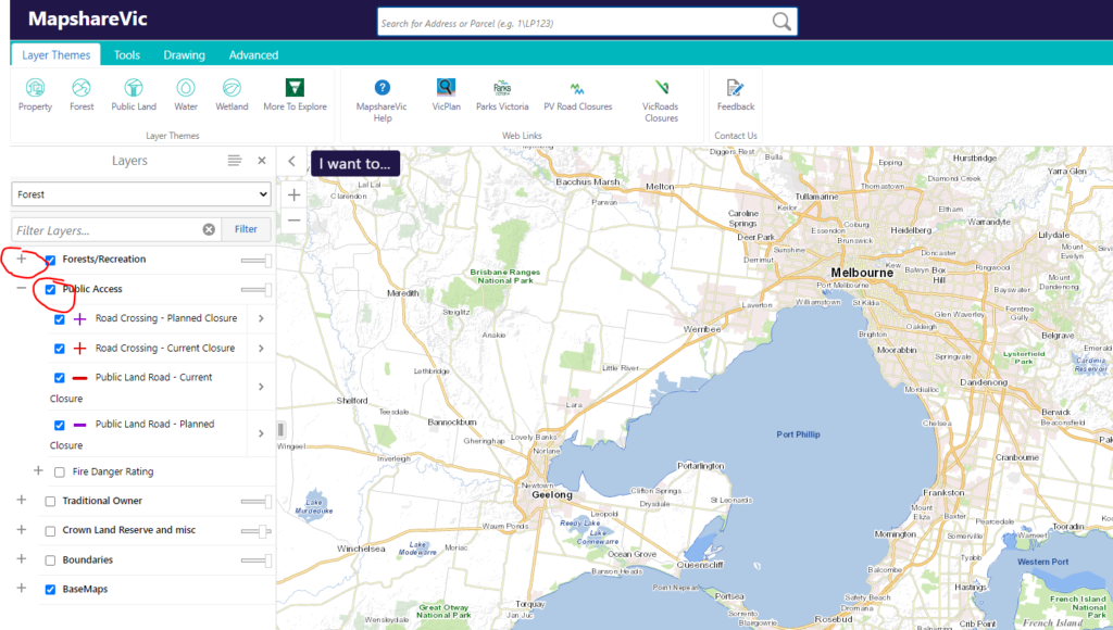
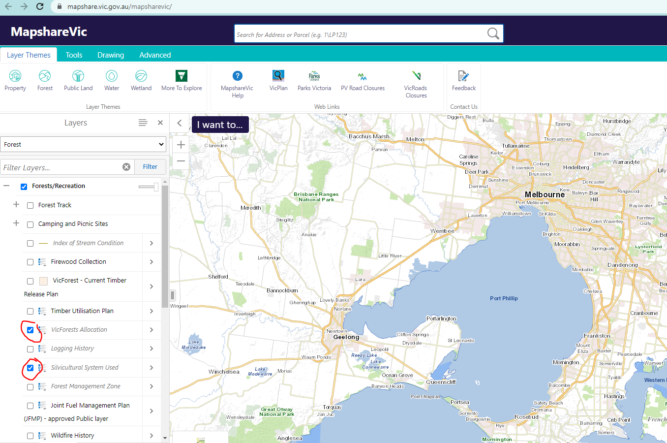
3. Untick the public access box and expand the Forests/Recreation filter by pressing the + 
4. Untick the Silvicultural checkbox and Tick the VicForests allocation tickbox. You can also tick the other Logging history check boxes to see the details of areas previously logged. 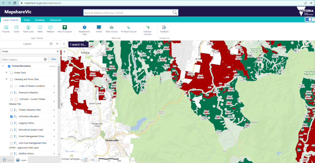
5. Move the map into the area you want to view and zoom until the information layers come up. Check out all your favourite trail running spots. You may be surprised by what the future holds for these forests. You can help by sharing what you find amongst your trail running friends. Empower them to learn more about the forests they use and how they can have their own opinions, voices and action to support their protection. Sustainable trails, environment and species for all the next generation trail runners to experience and enjoy.
For more info get involved with these amazing environmentally minded groups. They are leading the way and need our support to help facilitate change that comes with forest conservation. Tag them on your trail run socials when you’ve got a common message to share.
- Friends of the Earth Melbourne
- The Victorian Forest Alliance
- The Wilderness Society
- The Greens Victoria
- Patagonia The Great Forest
- For Wild Places
- Victorian National Parks Association
Happy safe and sustainable trail running
Trail Bus Tour Operator – Chris Wright
5 trail toys that make it into every day use
Whoever said running was a cheap sport obviously hasn’t been to an Amer outlet, Running Warehouse or Wildearth sale. All you need is a pair of shoes they said. They failed to mention the trigger gloves with your hiking poles or a quiver or a jet boil for fastpacking…… or terrain specific trail shoes. I am a true trail gear nut and tragic. I love trying gear and seeing what works for us, what doesn’t and how equipment is improved. Amongst all the exciting trail goodies we try, there are a few items I find making their way out of my running activities and into my every day urban rotation. I’m not yet at a point where I’m walking 1.7km to work with a 2 litre bladder in my backpack whilst eagerly chomping down cliff bars, but I’m pretty close to it. In this article I list my top 5 trail toys that get used off the trails and are actually really practical. I’d love to hear from what you guys use so drop a comment below.
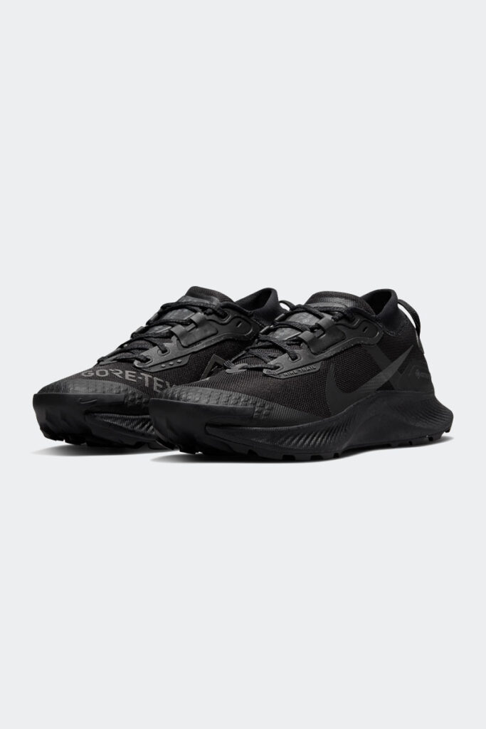
- Nike Pegasus Trail 3 Gortex in black. Use: Work, travel and impromptu running on and off the roads. Super comfy as a walking shoe, easy to clean being goretex and black (just wipe it down with some damp toilet paper in the airplane dunnie) and the black unassuming colour doesn’t raise any eyebrows at work. These are great day to day shoes when their is a slight chance that you may encounter a trail and you’ll find it too irresistible. Latest model $230 nike.com/au
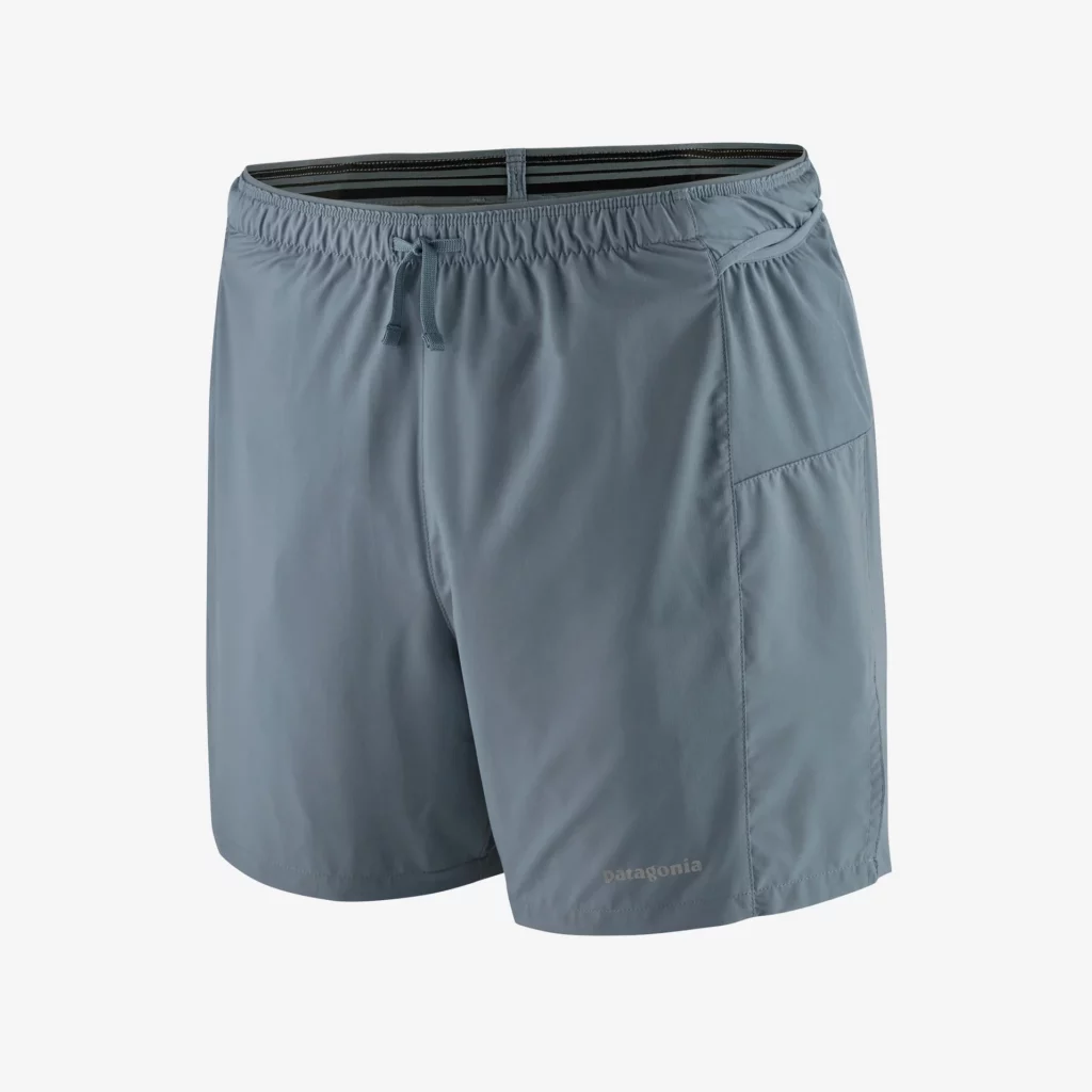
2. Patagonia 2 in 1 strider shorts. Use: Travel, swimming and impromptu running. How can Patagonia gear not get an mention with announcement that it is giving the entire company to a uniquely structured trust and nonprofit, designed to pump all of the company’s profits into saving the planet. These shorts are 2 in 1, plenty of pockets, quick dry and made from recycled materials. A great daily wearer and travel companion for dunking under waterfalls or a last minute trail bus tour sign up. $99 patagonia.com.au
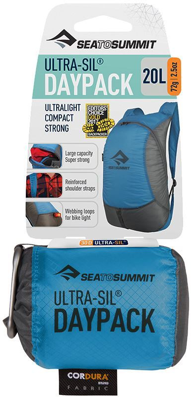
3. Sea to Summit Ultra sil backpack. Use: City, work, shopping. This extremely small and light backpack comes its own carbineer and packs down into itself small enough that it can be attached to a belt loop or pocket ready to be filled with whatever DFO bargains you accidently stumble across…. whoops new trail shoes $34.90 snowys.com.au
4. Sea to Summit pocket towel. Use: Gym, swimming, air travel, post run clean up and swimming. It’s a towel which fits in your pocket or in the above new back pack. It’s got its own case that prevents getting anything else it’s packed with wet. Make sure you get the large size as it’s big enough to wrap around your waist so you can get changed in it. The sense of reward you get when you have this thing is and need it is extreme. I love my pocket towel. $26.99 anacondastores.com

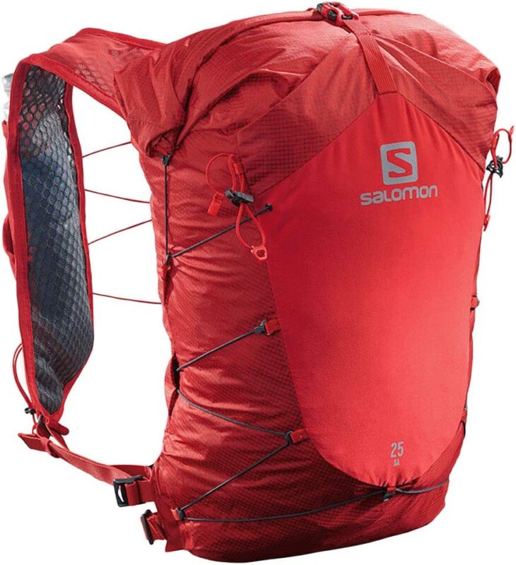
5. Salomon XA 25 Backpack/fastpack. Use: Day trips, air travel, work commuting. If you use salomon vests then you’ll love this backpack. Originally I purchased this for fastpacking (which it is ideal and designed for), but slowly and surely the wilderness and adventure crept into my trips to IGA express. I like this pack for the same reasons I like my salomon vests. The front loading and access capabilities are fantastic. I have my phone and keys separate so they don’t scratch. I can chuck a soft bottle in it. I can tighten it up to minimise bounce and if I need to do the Johnny bolt to a tram on St Kilda Rd then this pack is designed for that. What better way to spruik that I’m an outdoorsy type to the masses on the 109. $248.35 www.wildearth.com.au
We would love to have fellow gear nuts join us out on the trails with us. Whether its talking trail running clothes, emergency gear, tech or shoes these are some of our favourite topics. Until then…
Happy and safe trails. Chris Wright. Trail Bus Tour Operator and guide.
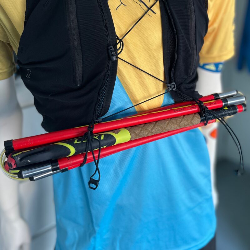
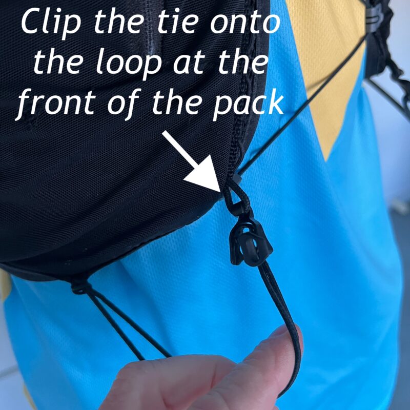
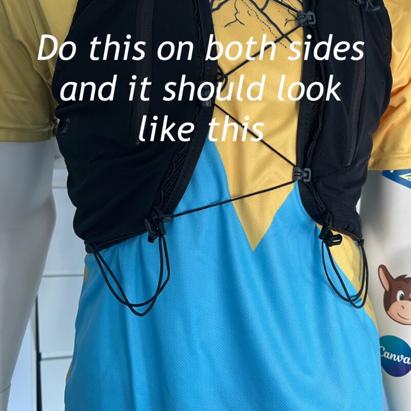
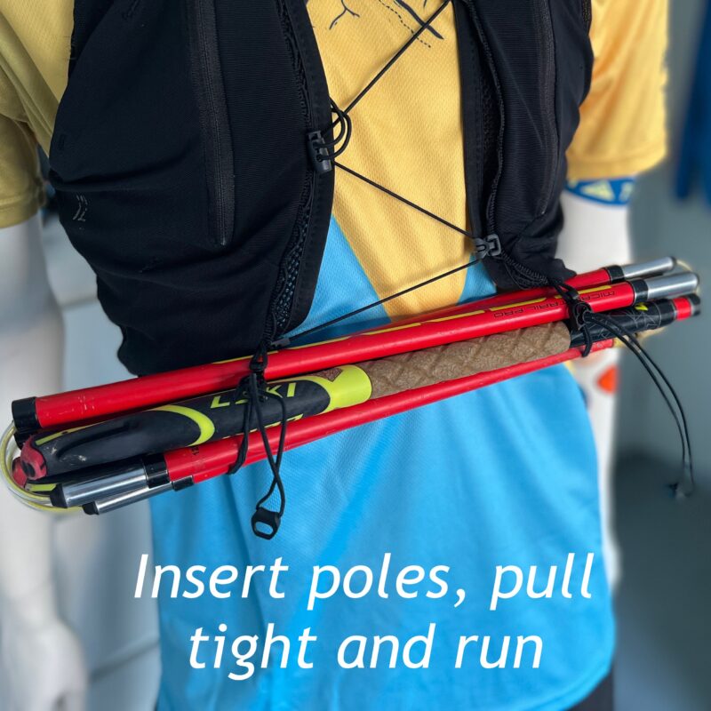
How to setup Salomon ADV 12 litre vest to front carry poles

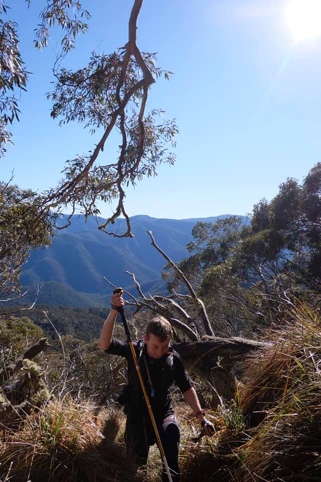
Hiking poles can be great tools for trail runners. When used correctly they spread the load and energy used in the legs to the upper body, taking off the edge of some of those more challenging climbs. Our guides carry poles to help conserve themselves, fatiguing runners, as safety tools to help with sprained ankles, as splints for snake bites and broken limbs.
Carrying poles is something the leading vest manufacturers have been considering in their designs for years. That gives us plenty of options to figure out what is the best place to store them when we aren’t using them. The options I use for pole storage are:
- Front side vest mount
- Front belly vest mount
- Rear lower back vest mount
- Rear quiver mount
- Front belt mount
- Rear belt mount
I like using the front belly mount position when I know I am going to be using and putting my poles away frequently. Usually on the runs with lots of hills or I need my hands to regularly to eat and drink and use my cameras. It is a great position for this because you can see what you are doing and it is relatively safe to do on the move. Note: it’s always safest to stop and do one thing at a time on the trails, particularly on technical trails.
I hope you enjoy this tutorial, please drop a comment and let me know if you find it helpful, have feedback or would like some videos on other subjects. I’ll add these videos to our youtube channel.
Happy and safe trails. Chris – Trail Bus guide and Tour Operator

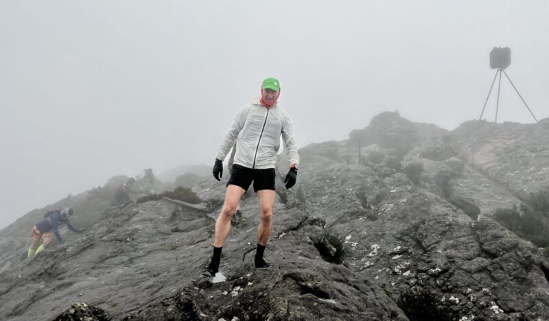
What does it take to get through a 9 jelly snaker?

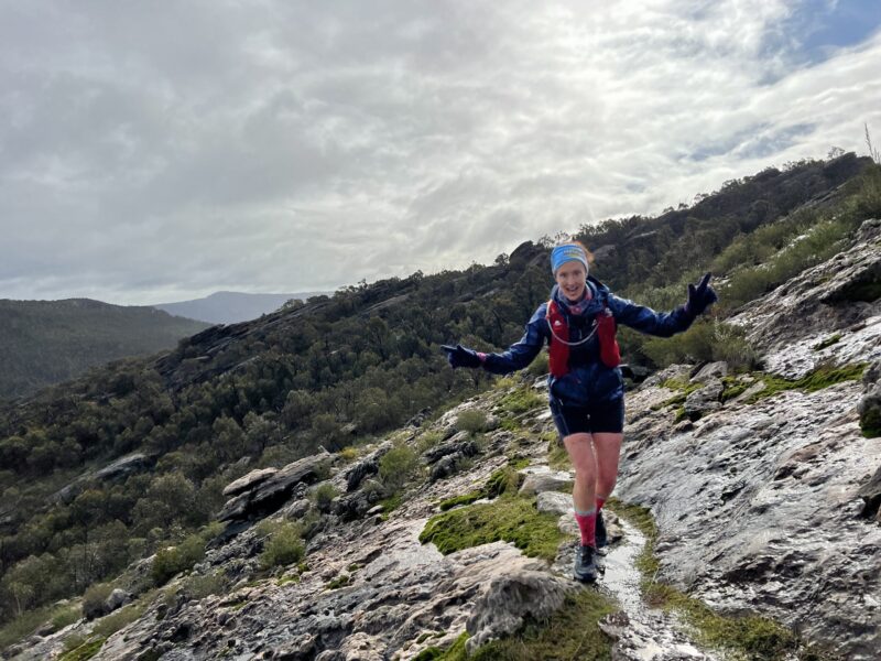
Trail running has so many rewards. Making those rewards extra sweet include navigating the challenges that present along the journey. The relationship between fun, fulfilment and accomplishment includes a healthy and balanced dose of challenge. This is something which is subjective for all adventurers. To help you work out how much challenge you are up for, we use our jelly snake tour challenge rating system. It takes into account different common challenge categories you’ll find on our tours and averages them out to give you an overall challenge rating for each tour.


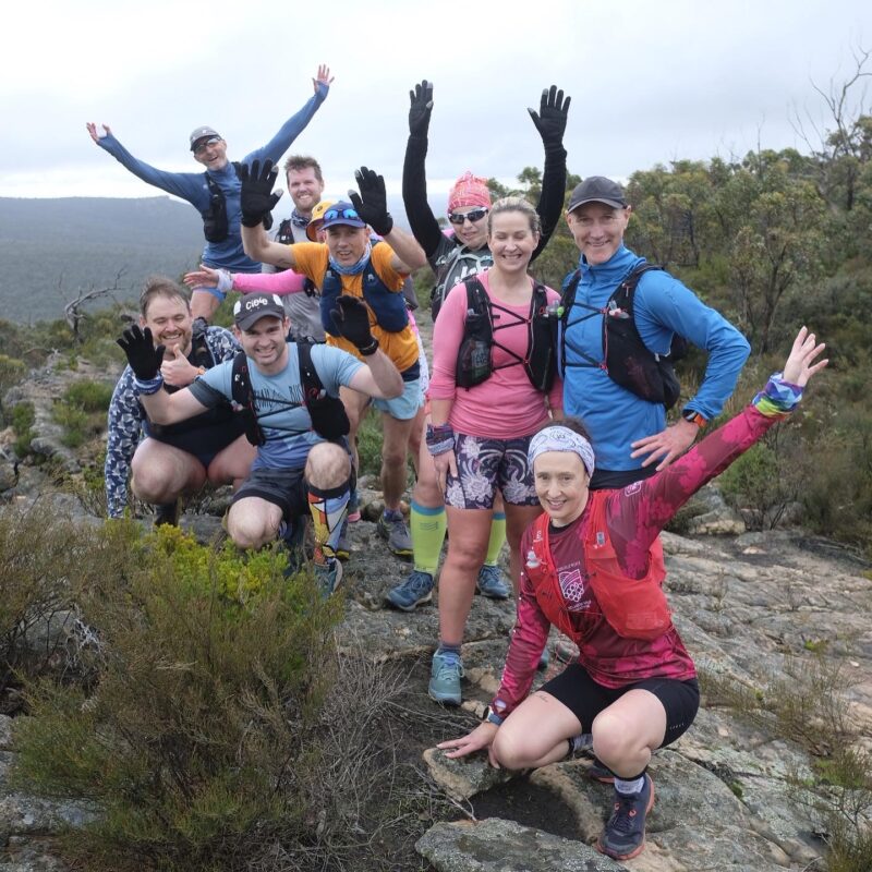
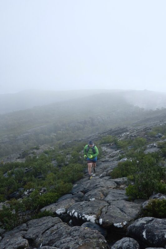
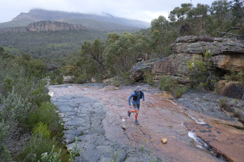
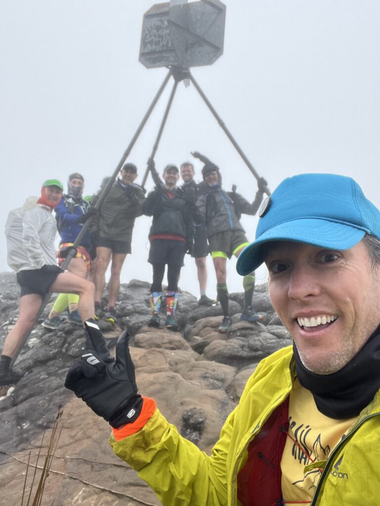
After our first section of our Gariwerd Grampians Peaks Trail Tour, which is one of our most technical and challenging tours (9 out of 10 Jelly snakes) we asked our adventurers what does it take to get through and get the most out of our most challenging tours. Here’s what our GPT crew said…
Will W – Don’t go out too hard too early. It will result in muscle fatigue and more waiting around. This also leads to getting cold and muscles tightening up. Enjoy the challenging sections, and know that finishing them, no matter how slowly, is a great effort. Also, the views are usually amazing at the end of a tough section. Or if you’re in the GPT the views are always amazing! Have some motivation to keep you going; whether it’s getting to a view or reaching the halfway mark or the brewery at the finish. 🍻

Will E – I should probably respond with something like “rock up half pissed from the night before so that you don’t know where you are for the first 10k and then when you realise it’s too later to turn back”. More seriously, more or less echoing what everyone else has said. Do everything just before it needs doing, eat before you’re hungry, drink before you’re thirsty, jacket/hat/gloves on before you’re cold. Have what you need to be largely self sufficient even on a well supported run. Don’t focus on the whole distance, break it down, and don’t get bogged down in “we’ve only done 9k in 3 hours. Oh and have more of everything. More water than you need, more food, more clothes.

Craig – Most would be familiar with the basics fuel nutrition gear but extremes of heat or cold can catch you out. The body needs consistency under these conditions so it doesn’t issue a panic response. Very much like the game plans I enjoyed observing this weekend of Annie Meg and Tim…even paced regular fueling and minimal stopping. My only advice is in cold slow moving alpine environments is to shift to much more nutrient dense fibrous fuel to keep that slow combustion fire going in the gut and keep stoking it with regular logs. Your gut will create good heat don’t let it burn low 👍.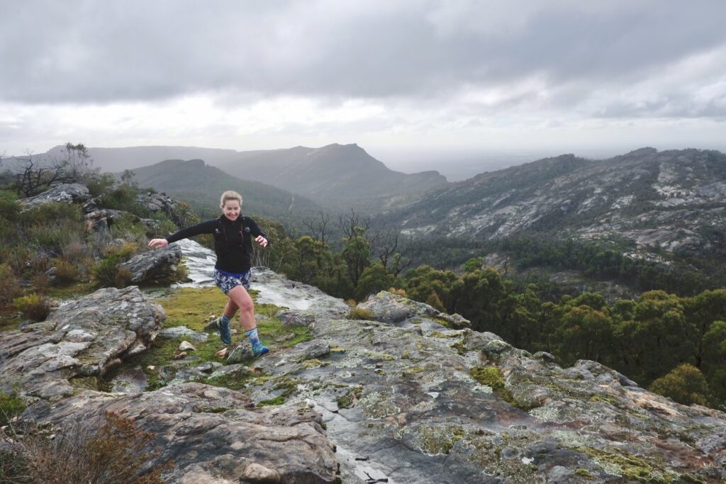
Annie – Decent breakfast and a goods nights sleep the evening before.
Tim – Quality footwear and be prepared for all different weather.
Meg – Pace yourself, fuel regularly, have a great crew around you. Avoid the hangry.

Jason – Take all the gear that Chris recommends, and don’t wait to use it. Your mind and body don’t work so well if you get too cold. Prepare to be out there longer than expected. It’s a mental game.
Ryan – Remembering to keep on top of your nutrition/hydration, especially early before you realise you need it. I’d also suggest stick to the beers that are <5%.
There’s some solid trail adventure advice in here. Check out our Jelly snake rating system page for more details or send us a message and ask us any questions. https://trailbus.com.au/tour-challenge-rating-system/
Happy and Safe trails
Chris and the TB team